An Alternative Vision for Macquarie Point
as a Place for all Tasmanians.
Our Place: a Tasmanian Vision for Macquarie Point
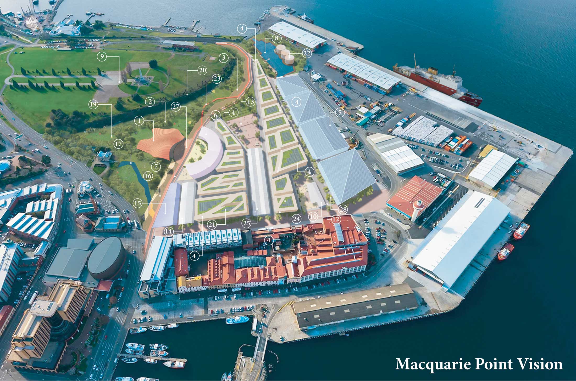
The Macquarie Point Vision is an iconic housing development of 1,000 new homes for 2,000-3,000 people that has as its centrepiece an enhanced, nationally significant Truth and Reconciliation Park. It speaks to what Hobartians need, which is housing, and what they want, which is reconciliation with the Palawa people. It is about Tasmania’s needs and values. It is about creating an iconic, internationally significant urban renewal project which answers our needs and addresses our problems. It is about hope and pride, truth and the future. It’s about our place.
The current Long House is maintained as a mixed use commercial hub (accommodating creative agencies, a fitness gym and an indigenous social enterprise) with minor modification to its north end to allow it to open out onto the newly developed sunny public space.
Cost
This vision for Macquarie Point would be developed and built in stages deriving funding from a mix of various state, federal and private sources. At 2023 costs the 1,000 homes have been costed at a total of $300 million, while the Truth and Reconciliation Park and the Indigenous Cultural Centre will cost $100 million, a total of $400 million.
Our Place: a Tasmanian Vision for Macquarie Point
The Macquarie Point Vision is an initiative of Our Place, a group of Tasmanians who wish to see development that benefits Tasmanians, not vested corporate interests. The creative work has been done in partnership with Bence Mulcahy.
Images referenced as part of the Macquarie Point Vision are representative only and not by Bence Mulcahy.

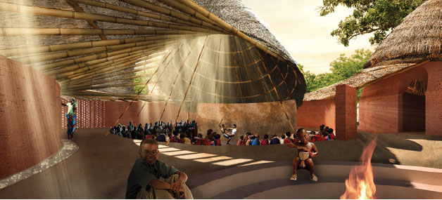
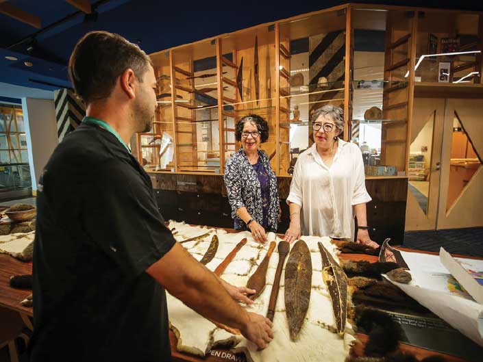
1. Indigenous Cultural and Heritage Centre
The Indigenous Cultural Centre is an essential place for gathering together Tasmania’s indigenous culture.
It accommodates performance, workshop, retail and gallery spaces, as well as offices, meeting, education and archive facilities.
The Centre’s location, at the heart of the Macquarie Point Vision, and the only new building on the pre-colonial shoreline, is in recognition of its significance, of the importance of indigenous people and culture in contemporary Tasmania and in recognition of our shared history.
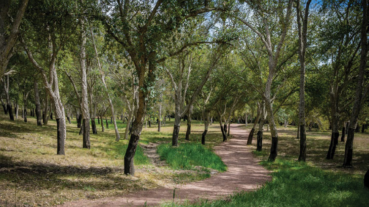
2. Truth and Reconciliation Park
The primary landscape element of the Macquarie Point Vision is the Truth and Reconciliation Park. This involves rehabilitation of contaminated industrial ground into a natural landscape reminiscent of the pre-colonial shoreline.
Native vegetation such as She-Oaks, Kangaroo Paw and Correa will provide shade, native grasslands become spaces for recreation, while sandstone outcrops create meeting spots and gathering points.
The Truth and Reconciliation Park will be activated by the Indigenous Cultural and Heritage Centre, and landscaped spaces around the Centre will accommodate community educational and cultural activities.
The park connects the city and waterfront to the Queens Domain and creates an opportunity for level access to the Cenotaph.
The allocation of meaningful space for the Truth and Reconciliation Park is a step toward the acknowledgement of our state’s history and recognition of the importance of indigenous people and culture as part of a future Tasmania.
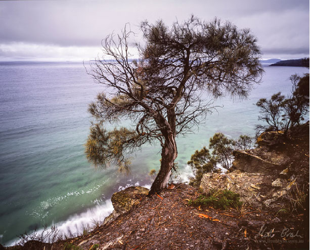
3. Shoreline Revealed
A key feature of this vision is the acknowledgement of the pre-colonial shoreline. This line organises the site into the Truth and Reconciliation Park (on the shoreline side) and new buildings and urban spaces (on the reclaimed land side).
200 years ago escarpments laced with thickets of She-Oaks and sheltered coves dripping with oysters would have characterised the shoreline. In revealing this shoreline we propose a series of landscape interventions along the route of the old shoreline. Wooded groves, rock outcrops and water features provide places to rest and reflect.
As the principle axis of the Macquarie Point Vision, the shoreline also marks the route of the light rail and main pedestrian/bicycle route through the site. This line also connects the site’s main pubic buildings, including the new State Library and the Indigenous Cultural and Heritage Centre, and the extension of this axis beyond the site ties together cultural institutions including the TMAG, City Hall, and the Federation Concert Hall.
4. Housing
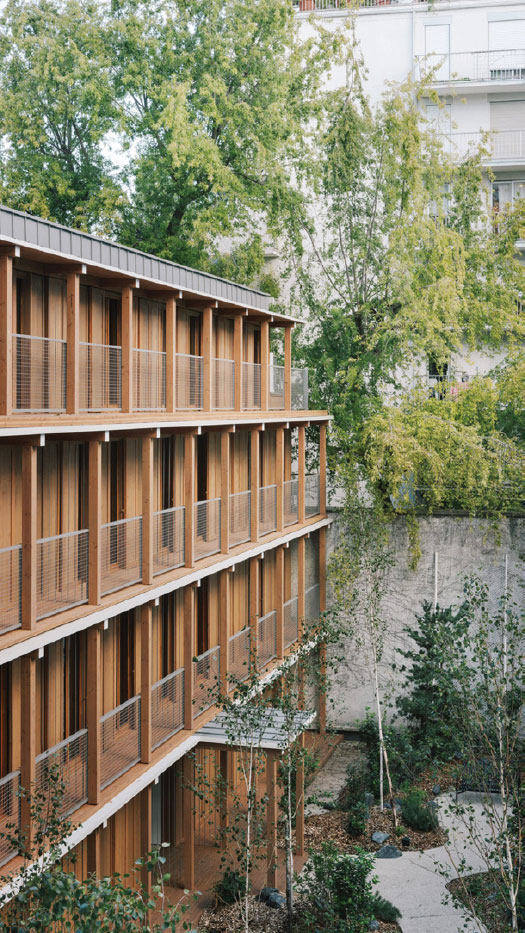
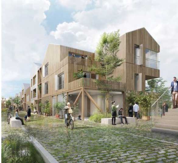
Housing is the major problem confronting Tasmanians in 2023. The Vision proposes more than 1000 dwellings for the site accommodating 2000-3000 residents. Dwellings vary in type and style with mixed tenure blocks accommodating private market apartments, key worker housing, community/government housing as well as crisis accommodation.
All housing on site will be world leading sustainable design. Housing will be designed, constructed and will operate carbon neutrally. Solar arrays will generate energy while green rooftops will improve energy efficiency, increase urban biodiversity and limit water run off.
Housing will be constructed of engineered timber, manufactured locally from sustainably managed local plantations, providing the utmost levels of energy efficiency, health and comfort to residents.
Construction methods will benefit our local industry and economy in developing manufacturing capacity, innovative construction technologies and employing Tasmanians.
Housing blocks are 3 to 5 stories high so as not to overshadow adjacent public spaces, and sit comfortably in scale with the existing neighbouring buildings and the natural landforms of the precinct.
Houses will be generous in size, light, warm and healthy, and will feature the highest levels of amenities ever experienced in Tasmania, including bike parking and end of trip facilities, secure resident storage, free solar electricity, gyms, pools and health facilities. The design will encourage social connections between residents and accommodate opportunities for local retail and conveniences.
This development will provide significant relief for Tasmania’s current housing crisis and importantly set a new benchmark for future developments.
5. Australian Antarctic Program Headquarters
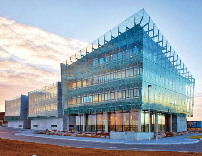
The Australian Antarctic Program Headquarters is proposed for location adjacent to Macquarie Wharf. This facility co-ordinates Australia’s scientific, environmental, logistical and transport activities in Antarctica and the Southern Ocean.
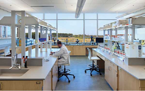
The building accommodates offices, meeting spaces, educational facilities as well as workshops, laboratories, storage and other specialist facilities.
The location provides direct access to the RSV Nuyina when docked, as well as allied wharf facilities and quick access to the Antarctic air link via Hobart Airport.
Main access is via Evans Street but it utilises the wharf side edge for vehicle and specialised access.
The Australian Antarctic Program Headquarters will be sustainably constructed utilising engineered mass timber. It will be light, bright and generous in amenity and its new city location will facilitate cross disciplinary collaboration with local institutions as well as a pleasant and convenient work environment.
The scale of the facility proposed provides opportunity for space over and above that currently accommodated in Kingston. The Vision proposes a sustainable, attractive and enviable workplace, the world’s pre-eminent Antarctic Headquarters, with direct access to Macquarie Wharf, the gateway to the Southern Ocean.
6. State Library
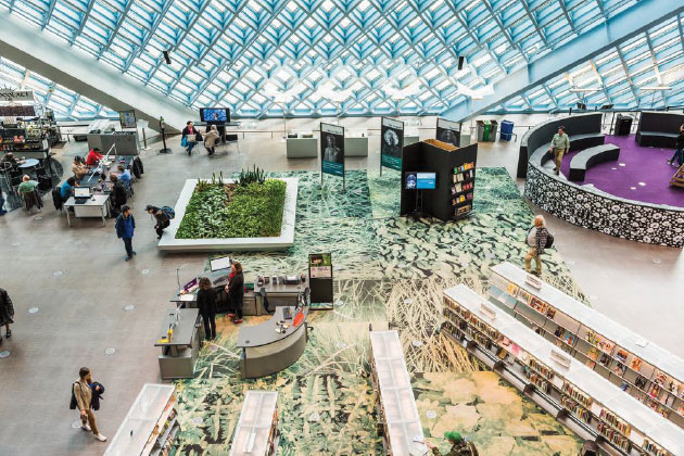
Anchoring the Vision is the new State Library. A modern sustainable, building befitting of Tasmania’s most loved and trusted institution.
Envisaged as a “public living room”. It is a place to grab a novel or flick through magazines, to conduct research or view an exhibition, to stream audio files and download movies, to meet a friend over tea and cake and to steal a quick nap in a quiet sunny nook. A building for all Tasmanians.
7. Sustainable Urban Transport Link
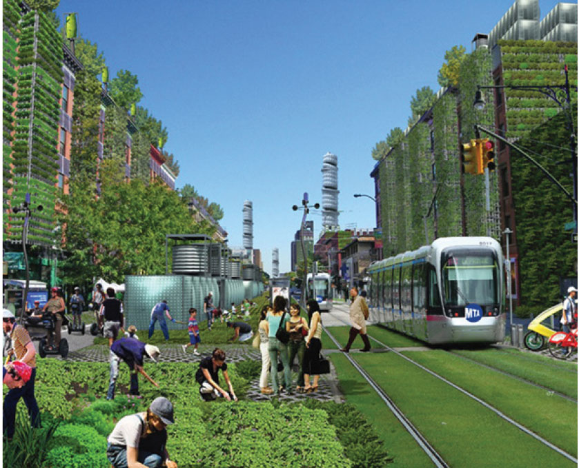
The development of the site is a catalyst for the implementation of an urban transport network of hubs laced throughout our city from Sandy Bay to Bridgewater. This high-speed battery-powered light rail service will connect communities, and support social development, urban regeneration, employment, housing, health, leisure, tourism and sustainability throughout the city and its fringes.
The light rail network will thread its way through the site, extending along the shoreline to the north and Davey Street to the south, increasing the connectivity of city life by attracting and moving significant numbers of people to and through the site and, most importantly, remarkably improving city traffic congestion.
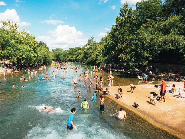
8. Wild Swimming Basin
Clean waterways are a key signaller of a healthy and sustainable city. The Macquarie Point Vision proposes the rehabilitation of the outdated dirty sewage works into a pristine cool climate wild swimming basin and the ultimate signal of Hobart’s new healthy green future.
Swimming is fun, healthy, keeps you fit, can be competitive or social; young or old can participate; it serves is a life skill, is low impact and not expensive.
In summer residents and tourists can see and be seen sunning on the basin’s shady edge, while in depths of winter hardy souls will gather like a fraid of shivering ghosts in the frosty jerry before slipping into its inky wetness for that icy life affirming dip.
The wild swimming basin would be created by removing the sewage works and diverting the Hobart Rivulet into the new natural basin.
By embracing the water’s pilgrimage from kunanyi to the Derwent we are celebrating the tangible connection of the site with the wider landscape.
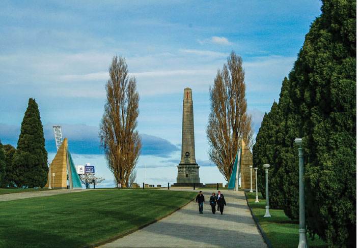
9. Cenotaph
The Cenotaph is a key driver in the site planning. Public spaces are designed to provide views to the Cenotaph, orienting us within the city and providing connection to the greater landscape. The Truth and Reconciliation Park provides a buffer between the Cenotaph, its landscape and new developments. The Vision recognises the Cenotaph’s cultural importance as a place of reflection and with dignity and respect it grants it due space.
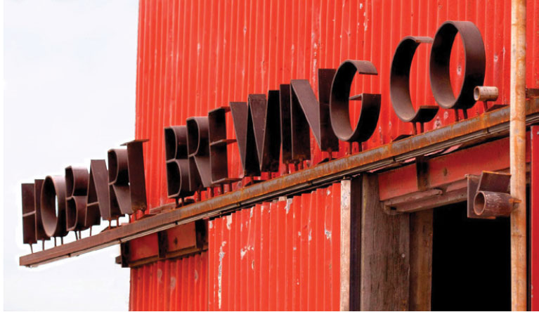
10. Red Shed
The Red Shed currently occupied by the Hobart Brewing Company is maintained and enhanced with the addition of a public square. Its grit and texture are retained as a place where residents can sip a cheeky beer while walking the dog, visitors can sample a local, or a sub-antarctic scientist can smash some frothies after returning from a winter season. A place for all to say “cheers to Hobart”.

11. Safety and Security
The Macquarie Point Vision proposes spaces that are safe, secure, robust and people friendly. Self generating solar lighting will be abundant and public spaces will be designed so that security is inherent, with passive surveillance and residential oversight.
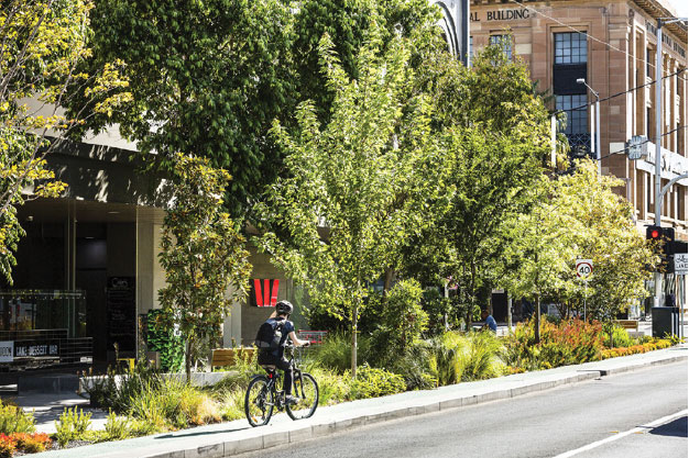
12. Vehicle and Pedestrian Streets
Primary street access into the Macquarie Point site is via Evans Street. Streets are located adjacent the existing site buildings (Long House/Goods Shed/Red Shed) and, while convenient, this also extends the existing opportunities for sneaky ambling pedestrian connections through the existing Henry Jones/UTAS precinct from the waterfront.
Streets are 2-way with a dedicated cycle lane and ensure access to all buildings. Street layouts do not allow vehicle access all the way through the site. Street widths accommodate parking where required but preference pedestrians with generous footpaths, quality street furniture and vegetation.
The streets are sustainable and friendly. The Vision proposes electric fast-charging points in parking locations, impervious paving, bio-swales and rain gardens to limit, catch and treat surface water, and self generating street lighting for safety and amenity. Streets will be activated by “lived in” features to generate community connectedness such as mini street libraries and street side stalls where residents can pass on that thumbed copy of Fifty Shades of Grey or offload an excess of the summer’s jam.
13. Plaza Square
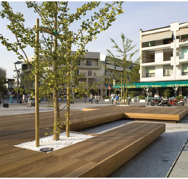
The central square is a north facing public space orientated to the sun and the Cenotaph. Commercial activity serving local residents activates the edges of the square at ground level. At the northern periphery, the square terraces up forming a natural amphitheatre and the perfect space for large public gatherings.

14. The Long House
The current Long House is maintained as a mixed use commercial hub (accommodating creative agencies, a fitness gym and an indigenous social enterprise) with minor modification to its north end to allow it to open out onto the newly developed sunny public space.
15. Transit Hub
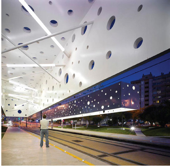
At the gateway to the Macquarie Point Vision is the Transit Hub. This is the primary light railway interchange and a place to rack securely and recharge your bike or scooter for the day and grab a coffee before heading into the city or further afield. The building respects the Davey Street alignment and is set back to maintain views into and out of the site.

16. Welcome Forecourt
The welcome forecourt is the entry to the Macquarie Point Vision and its direct connection to the city. Edged by the newly exposed rivulet and with views to kunanyi, the forecourt space sets the precedent for the overarching site agenda, the natural connection between summit and sea. The forecourt is activated by the flanking buildings, the new State Library and the Transit Hub.

17. Surging Rivulet Exposed
Cascading from the scree slewn slopes above the city, the Hobart Rivulet’s crystal clear waters were the lifeblood of the new settlement. Since foundation times the city has grown and has suppressed the natural expression of the Rivulet, ultimately burying it and piping it to the sea.
This vision rewinds 200 years of history celebrating this natural feature. The Vision proposes revealing the Rivulet at the historical confluence of the Park Street and Hobart Rivulets where they joined as one to flee the confines of the foothills and flow into the Derwent, near Hunter Island. To pass through the site means traversing the mouth of this city making watercourse, in the footsteps of all those who trod these shores past.
18. kunanyi
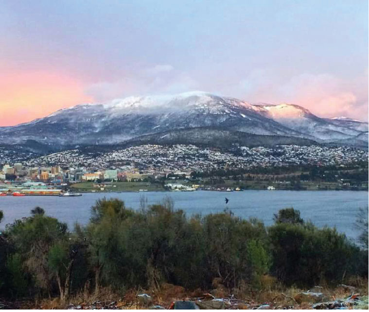
The presence of the mountain is inherent in the site planning. Key public spaces are designed to provide summit views, orienting citizens in the city and making connections to the greater landscape. The revealing of the Rivulet and the redevelopment of the pre-colonial shoreline emphasises the river and the mountains as connected natural entities.
19. Public Art
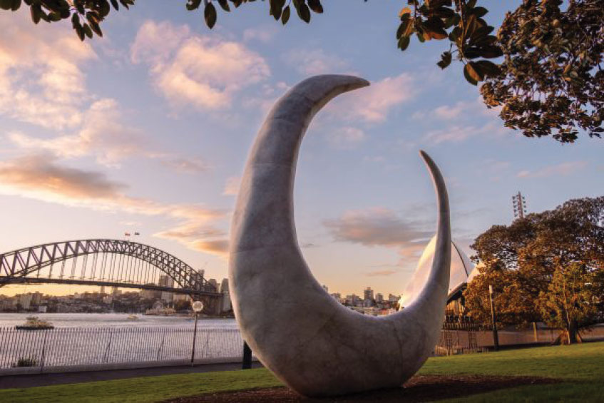
The vision proposes a significant network of site specific public art commissions throughout the site. Public art will vary in scale and medium, some interactive and playful and thought provoking. A focus of the public art will be nature based pieces and indigenous artists.
20. Escarpment and Cenotaph Hill
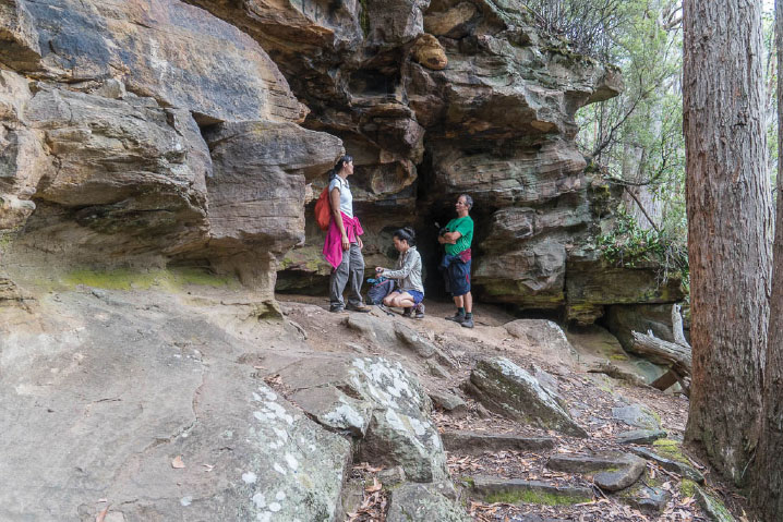
The Cenotaph hill and escapement are recognised as key landscape features of the wider precinct. The Vision proposes an exclusion zone from the escarpment to the old shoreline free of development. This allows a clear reading or understanding of the natural landscape and due reverence to the Cenotaph hill. Landscaping in this zone will create the opportunity for level access from Macquarie Point to the Cenotaph hill.
21. Solar Power Generation
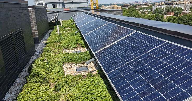
Building roofs will accommodate Australia’s densest and most interconnected urban network of solar arrays. Each building will feature battery storage facilities and provide opportunities for building users to access generated energy or if excess, then for redirection back into the grid. Each building will also accommodate electric charging stations within carparks.
22. Post Industrial Infrastructure
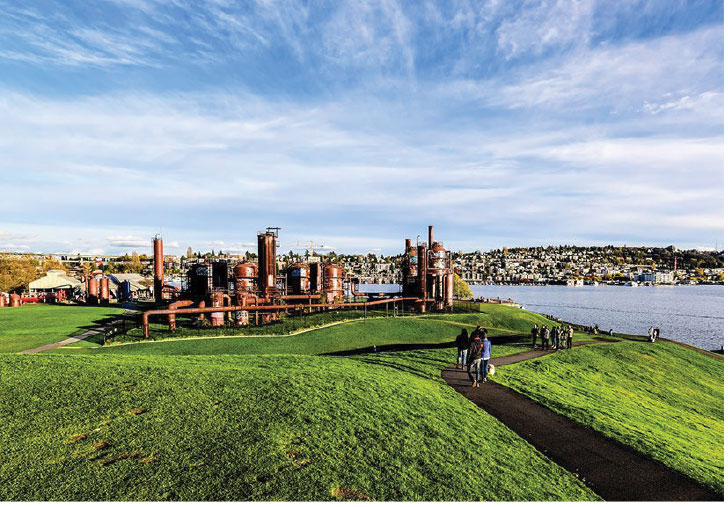
As testament to this precinct’s industrial history, selective retention of the non-operational sewage treatment infrastructure is proposed. The giant tanks, spiralling staircases, gantries and pipes will form an interesting and beautiful sculptural backdrop to the wild swimming basin.
23. Pedestrian and Cycling Super Connector
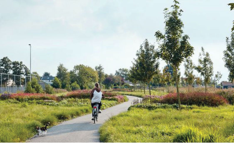
The Pedestrian and Cycling Super Connector traces a route along the old shoreline. Safe, sustainable, efficient and interesting this dedicated pedestrian and cycle path brings the popular northern suburbs cycle path into the heart of the city.
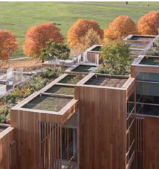
24. Green Rooftops
Residential buildings will feature green rooftops. Green rooftops reduce stormwater runoff, improve building thermal performance and energy efficiency, and create wonderful opportunities for increased urban biodiversity.
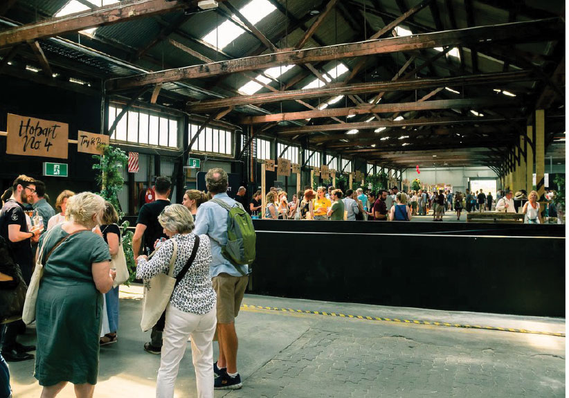
25. The Goods Shed
The current Goods Shed is retained and reimagined as a loose-fit, all-weather, multi-function commercial space. At any time one might wander in and find pop up retail, regular markets, a temporary seasonal restaurant or a gig space. The sunny north end of the shed opens up to the Plaza Square encouraging indoor outdoor events.

26. Cost Efficient and Debt Free Staging
The Macquarie Point Vision does not rely on being undertaken as a single construction project. It is designed to be constructed as a series of smaller scale project stages. The advantage of this is that it does not rely on a single large Government financial commitment. It can be funded by the state over a number of budget cycles and matched with contributions from private investors, where they benefit.
The Vision is “loose fit” so can evolve should circumstances change. It is designed to be of maximum financial benefit to the state. Because construction stages are of manageable scale it is designed to be built entirely by local contractors with the capacity of our local construction industry, rather than relying on a single large multi-national building company.
The Macquarie Point Vision is a financially intelligent, and economically responsive approach to developing the site that does not saddle future generations of Tasmanians with an ongoing debt.
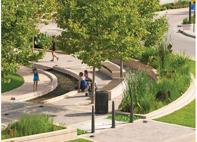
27. The Round House Ring
The circular configuration and location of the existing round house is acknowledged in this public space. Buildings surrounding the Ring peel back to ensure views from the space to kunanyi and the Cenotaph are maintained. The Round House Ring is an open landscaped space, activated by the neighbouring buildings. The new State Library cafe and entry open into the Ring while the Indigenous Cultural and Heritage Centre utilises the Ring for formal ceremonies and large gatherings. The pedestrian, cycling and light rail routes transverse this space.
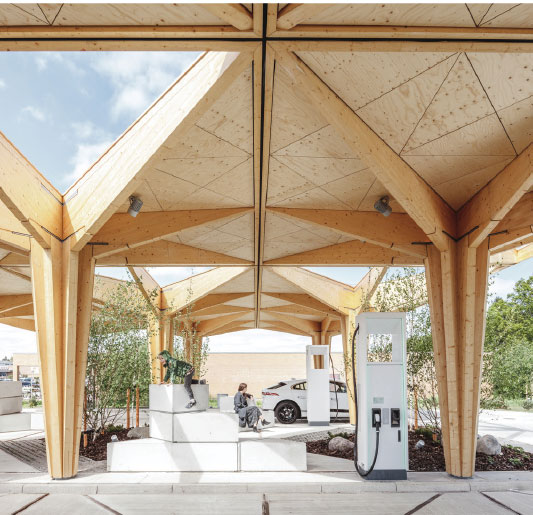
28. Parking and Charging Stations
Electric charging stations will be located in parking clusters. These will be serviced from solar energy generated on site and available to visitors and residents.
Let’s build something
amazing together
Start the discussion now!
Share this website on your social media
